


Charles Schumer, a US Senator, spots a cause for concern, regarding the development of high quality mapping available for the public. Google and Apple are reportedly preparing to improve their Maps applications by making high quality snaps of the world using military grade spy planes. The keyword here is ‘Spy‘. According to the report, the cameras from the spy planes of Google and Apple are well capable of taking high quality snapshots of not only the road, but our homes as well. Picture this, something as small as four inches long can be identified using that camera from that height.
This raises a very valid concern. While these spy planes have a very useful application in military strategy, to use such equipment on civilians may very well let all their doors open to the public. Okay, that may be an exaggeration, but being able to 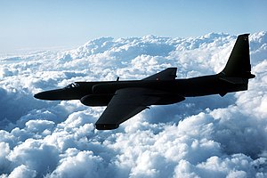 see through my window, or see me clearly on a map snapshot, and without my knowledge, show these images to the public, is a tad too much for a mapping application.

- Things like these should be removed from maps

Sure, there are times when we would like to joke around and show our friends where our house is in the “satellite” view of maps. The street view option from Google maps was very useful in planning for trips and scouting the area to familiarize myself. Apple is also adding such a feature to rival Google in the Mapping arena. I would definitely understand that there will be a need to have a general, realistic view of an area to push the mapping technology to provide better accuracy. Still, it is very inappropriate to have a person or the interiors of the house be visible and be so detailed in the mapping applications. You wouldn’t want to be caught changing while the camera from Apple and Google’s spy planes capture you butt naked.
Charles Shumer had some ideas though; he also sees that mapping needs to take these accurate shots for the purpose of accurate mapping and navigation, but limits should be imposed. One idea was for Google and Apple to inform the masses when and where these spy planes will take the shots, so that people can avoid being caught by the camera. I think it would also help if they did not camouflage these spy planes. If the people are aware it’s in the sky, there might be less to do in the next step that Charles Schumer proposes.
The next step he proposed was for these snaps to be reviewed intently, and blur out any sensitive data that may have been caught on camera. This includes blurring or possibly removing a person from a snap. We know this is possible, just a couple of Photoshop edits here and there. They can make glass opaque to make sure none of the insides of any building is displayed. Its also a great idea for people to report unedited areas, or to be able to remove themselves from maps. Although, once its been released to the web, anyone can screenshot the scene, forever saving it on the internet. Prevention is still better than cure. So Apple and Google need to step up and prevent these mishaps.
They may argue that this is an additional expense for these tech giants, but they were able to afford all those nifty spy gear, right? Surely they can spend a few more billions while making sure that people can still trust them with the information they continuously gather left and right. What more can you suggest to make sure that accurate maps can avoid privacy issues?
Image sources: phys.org, talkingpointsmemo.com, urlesque.com, wikipedia.com

")

